• Welcome to RCCrawler Forums.

    It looks like you're enjoying RCCrawler's Forums but haven't created an account yet. Why not take a minute to register for your own free account now? As a member you get free access to all of our forums and posts plus the ability to post your own messages, communicate directly with other members, and much more. Register now!

    Already a member? Login at the top of this page to stop seeing this message.

Utah Crawling Atlas

PinchFlat

Say hello to my dactylion
Joined
Jun 4, 2004
Messages
4,470
Location
On the Boat to Whore Island
The birthplace of Utah RC Crawling:
Kiwanis Park in Pleasant Grove

NAME: The Birth Place
LOCATION: Kiwanis Park, Pl. Grove
TERRAIN: Large piled rocks/river bed
TRACTION: All types

mapkiwanis.gif


One of the local favorite Legendary spots of Utah RC Crawling:
Little Moab, Elberta

NAME: Little Moab
LOCATION: Elberta
TERRAIN: White slickrock/sand
TRACTION: Varies med to high

maplilmoab.gif


Another GREAT spot in Southern Utah:
Red Rock Park, St. George

NAME: Red Rock Park
LOCATION: St. George
TERRAIN: Red slickrock/sand
TRACTION: Varies med to high

mapredrock.gif


We can't forget Black Rock:
Black Rock

NAME: Black Rock
LOCATION: just west of the Salt Lake Marina On the Great Salt lake
TERRAIN: Small to large jagged bolders, sand
TRACTION: Very low to extremely high

Black Rock is just west of the Salt Lake marina on the Great Salt Lake. From West bound I-80, take the Saltair Exit head West on the Frontage road North of the freeway. Follow it about a mile take the dirt road on the left and you cant miss.
 
Last edited:
I think pinch forgot about this little place called MOAB!!!!"thumbsup"
 
New awesome crawl spot for 801RCC and the Utah crawling crowd!!!

Heard there was a good spot out in the West Desert near Topaz Mt. So my wife and I decided to head out for a day of Geocaching (her hobby) and while out there, look for good crawling spots (my hobby).
We spent most of the day at Topaz Mt looking for geocaches, and found a bunch. There were a bunch of good crawling spots but nothing condensed enough to keep you busy for more than an hour or so. I figured the trip wasn't a loss, I spent the day geocaching with the wife and really enjoyed spending some quality time with her.
On our way home from Topaz Mt near the Intermountain Power Project we saw a sign saying "Desert Mountain" and a road heading north. We figured we'd seen Topaz Mt. why not check out Desert Mountain too. We followed the dirt road 16 miles and what do ya know.
Desert Mountain is a huge area, absolutely perfect for R/C crawling. We arrived a bit before sundown, so I didn't get to log much drive time but I did get in a pack with the 2.2 and about 20min on the MRC. This area is huge!!! Kinda broken into 3 or 4 large areas, each area is roughly 2 times the size of Lil Moab, :shock: and you could crawl forever out here without ever hitting the same line twice.

Here are the directions:
Head south on I-15 to Nephi. Take the second exit, Hwy132. Follow Hwy132 west for 33miles, it will then run into Hwy6. Head south on Hwy6 for 6miles. Turn northwest on Hwy174 (you'll see Brush Resource near the intersection) follow Hwy174 11miles. A mile or two past Intermountain Power Project you'll see the sign "Desert Mountain". Follow the dirt road north 16miles and you'll see the spot on the east side of the road. The dirt road is very well maintained (smoother than the road to Lil Moab) and you can easily do 50mph. Any car can make it to this spot.

WVH to Nephi (I-15) = 68miles/1:05min
Nephi to Hwy6 (Hwy132) = 33miles/35min
Hwy132 to Hwy174 (Hwy6) = 6miles/6min
Hwy6 to Desert Mt rd. (Hwy174) = 11miles/13min
Desert Mt turnoff to crawl spot (Desert Mt rd) =16miles/18min

WVH to crawl spot = 140miles/2:15min
Desert Mountain Crawl Spot, GPS coordinates
N 39*44.284
W 112*35.799

Here are some pics we snagged.

Here is a close up of the rock. It's very grippy!!
DSCF1328.jpg


Some pics of the area near the GPS coordinates. This area is huge and seams endless.
DSCF1325.jpg


DSCF1332.jpg


DSCF1333.jpg


DSCF1334.jpg


And some pics of the little bit of crawling I got in.
DSCF1322.jpg


DSCF1323.jpg


DSCF1327.jpg


DSCF1329.jpg


DSCF1330.jpg


DSCF1331.jpg


DSCF1335.jpg


DSCF1337.jpg


Wife drove the 2.2 for a bit while I ran the MRC.
DSCF1336.jpg
 
Last edited:
West Wendover

Well I had a customer tell me about this spot.

GPS coordinates (the lower one is the one my GPS uses)
40.736723, -114.098768‎
+40° 44' 12.20", -114° 5' 55.56"

Here are the direction
Take the Peppermill/Rainbow exit just passed the state line in Wendover. Head south to Wendover Blvd. Take Wendover Blvd west one mile, take a left at the Smiths (heading south). Fallow the road one mile till it turns to dirt. At this point you can see a small rock mountain directly in front of you. follow the dirt road 1.2 miles to the south west side of the mountain and BAM!! there you are.

Here are a few pics I took while scouting the spot.

DSCF3094.jpg


DSCF3093.jpg


DSCF3092.jpg


DSCF3099.jpg


DSCF3096.jpg


DSCF3098.jpg
 
There is a full scale man made rock crawling course in Delta at the fair grounds it looks sweet haven't tryed it yet but can't wait to go back and try it. There is also a good place to go at Sand Hollow. Just drive past the boat launching area to the end and there is a good place for beginners to advanced it is great place to go.
 
There is a great little RC crawling spot off of 300 south in Provo called Slate Canyon. You just take 300 south eastward until you hit the foothills and you will run right into a run-off stream bed. Excellent RC crawling for anyone that wants to check it out. "thumbsup"
 
Ogden Area

If you are up in the ogden area (Or the space on the map between Idaho and Salt lake that these guys refuse to talk about) Sandridge park in Roy is awsome and the top of 9th street.
 
Here are some pics of Black Rock by the GSL.

Great place to come and play, my bro in law and I spent most of the day out here playin.Good for comp and scale.


135.jpg


133.jpg


Scale fun oh and a mini losi.
142.jpg


145.jpg


My AX10 and his redcat.
137.jpg


136.jpg
 
Kiwanis Park, Pl. Grove

I went here with a couple guys yesterday. We did not find much there, a couple of small but fun spots by the stream. How much more is around there?
 
Last edited:
Nice area for scale and crawl, in Ogden @ the tippy top of 9th street (have to be on harrison to get to top) about 1/4 mile up to the NE trailhead until you reach the end of the concrete run on the E side. Awesome spot to run all day
 
if your in slc there is a great place on 500e and 1700s on the south west corner cant miss it and a good place in a park on 1700s and about 1700e its a park on the north side of 1700s cant miss it
 
Slc/Murray

If your in the Slc/Murray area there's a pretty sweet lil spot on Woodoak Lane (5400s.) and 640 E. It's on the northwest corner of the cemetery, you have to be on 640 E. to see it..... here's some pix with my AX-10


008.jpg


006.jpg


009-1.jpg


001.jpg
 
x2 for 9th in Ogden!
I was able to make it up there today and it was awesome! Here are some pics. Drive to the top of 9th, park on the side of the road at the gate. Walk through the gate on the blacktop past the 2 little buildings, immmediately turn left, then right at the fence. Follow the trail up, cross a dirt road, follow the trail and you're there! The little red lines are where I walked and the dots are where I crawled.
5965609662_1a83eace90_b.jpg

5965037819_a6dd8d76a1_b.jpg

5965036235_4771d2256d_b.jpg

5965595004_58696576d6_b.jpg


I had a ton of fun with my little MRC Pro, looking to get a scx10 and scale a little up there! Rocks face south/west and it was pretty warm so take some water. There are cactus along the way too so wear some decent hiking shoes. LMK when we can crawl!
 
Last edited:
GreenRiver, UT

Crystal Geyser near GreenRiver. Plug these coordinates in your gps or google maps/earth and it will take you right to it (38.938135,-110.134974)

e38d6bb0.jpg


0ec42728.jpg


92942dc5.jpg


788afea6.jpg


2d794722.jpg
 
Last edited:
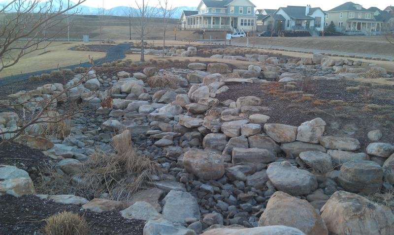
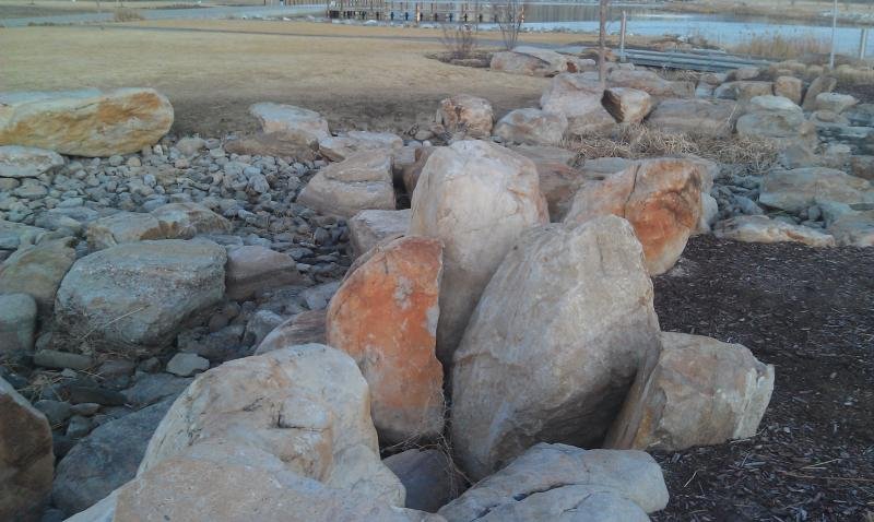
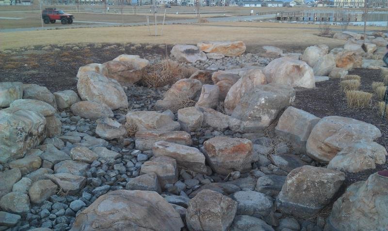
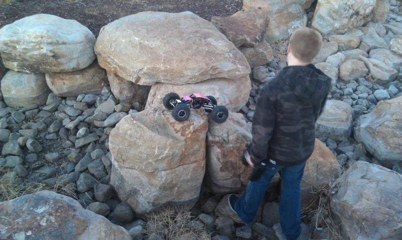
DAYBREAK LAKE - SOUTH END

Nice little spot my son and I hit up every weekend. South Jordan, North end of Day Break Lake. When the city has the water shut off during the winter it's a really fun spot

10400 so and west of Bangeter Hwy, Go west until you hit the 1st round about and you will see the lake and the docks on the west side if the lake. You can't miss it, this is just a little bit of whats out there. This place has a ton of spots all around the north end of the lake. Just go out and look..... It's a 2min drive for me, so I really like going whenever I get minute.
 

Attachments

  • IMAG0365.jpg
    IMAG0365.jpg
    78.4 KB · Views: 6,719
  • IMAG0368.jpg
    IMAG0368.jpg
    64.6 KB · Views: 6,672
  • IMAG0367.jpg
    IMAG0367.jpg
    72.1 KB · Views: 6,619
  • IMAG0366.jpg
    IMAG0366.jpg
    68.5 KB · Views: 6,650
Last edited:
Nice little spot my son and I hit up every weekend. South Jordan, North end of Day Break Lake. When the city has the water shut off during the winter it's a really fun spot

10400 so and west of Bangeter Hwy, Go west until you hit the 1st round about and you will see the lake and the docks on the west side if the lake. You can't miss it, this is just a little bit of whats out there. This place has a ton of spots all around the north end of the lake. Just go out and look..... It's a 2min drive for me, so I really like going whenever I get minute.

I'll have to hit that place up, I live about 15minutes away from there.
 
Back
Top